

Mysterious burial chambers, Roman towns and Celtic crosses are just a few of the amazing ancient sites in Wales you’d encounter. This is a country rich in history – some of the stones of Stonehenge came from there, and it’s one of the best places in the world to see medieval castles.
In this article I’ll show you the best ancient sites around Wales to visit around the country. They date from the Neolithic period around 5,000 years ago, include the Bronze Age, Iron Age and two fascinating Roman sites. We finish with two of the most sublime Welsh Celtic crosses to have survived, which date from the 10th or 11th centuries AD.
I’ll describe each site in detail, and advise on how to get to each of them. I’ll also suggest places to visit near each ancient site, and a few places to stay along the way.
All of these Welsh ancient sites are free to access except for the Great Orme Copper Mines, details of which are in the relevant section of the article.
Pentre Ifan
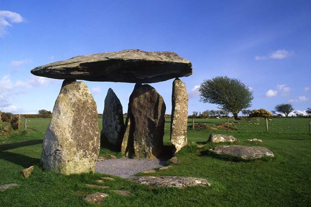
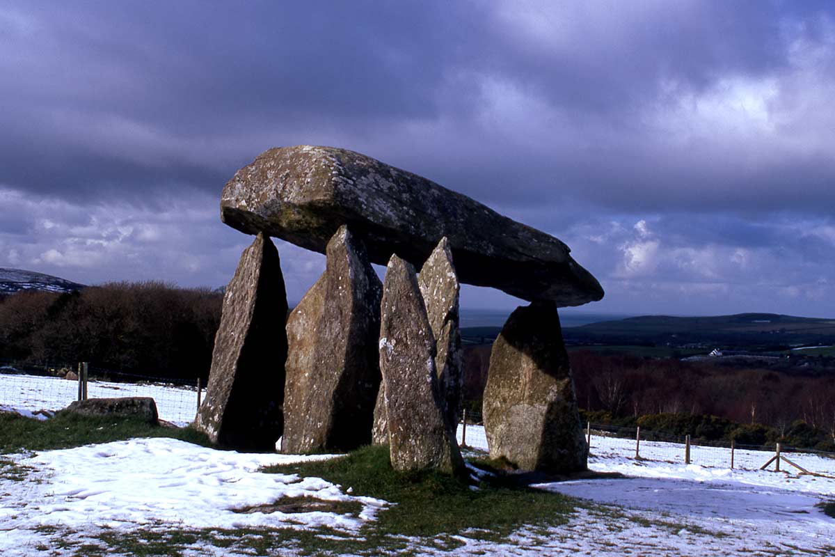
Pentre Ifan is perhaps the most iconic cromlech (chambered tomb) in Wales. It’s one of the best-preserved, and also has a superb setting, with views over the north Pembrokeshire countryside in one direction and Carn Ingli and the Preseli Hills in the other.
The bluestones that still stand there today are from the nearby Mynydd Preseli, from which some of the stones for Stonehenge were also sourced. These stones would have formed part of a much larger structure, the rest of which has long since been destroyed and dismantled.
Pentre Ifan – which means ‘the ‘village of Ifan’ or ‘the village of John’ – was constructed in the Neolithic period, around 5,000 years ago. It’s well signposted from the main A487 road, and open daily between 10.00 am and 4.00 pm. You enter the site via a gate which is sometimes locked outside opening hours, so don’t turn up outside these hours as you may not be able to see the monument.
Where To Stay – Llys Meddyg – beautiful Georgian country house on the lower slopes of Carn Ingli
Nevern Churchyard Cross
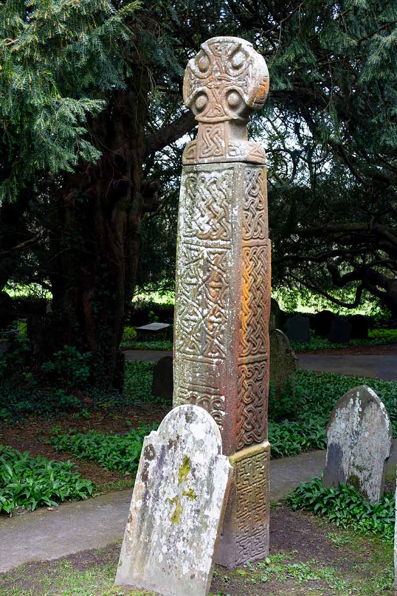
The Cross of St Brynach is only a few miles’ drive from Pentre Ifan. It dates from around the late 10th or early 11th-century and is one of the most beautiful Celtic crosses in Wales.
It’s in the churchyard of St Brynach’s church in the village of Nevern (Nanhyfer in Welsh), in the north of Pembrokeshire to the east of Newport (Trefdraeth). It’s 3.72 metres high, and very similar to the Celtic cross at Carew, in south Pembrokeshire – it may have even been made by the same craftsmen.
Capel Garmon Burial Chamber
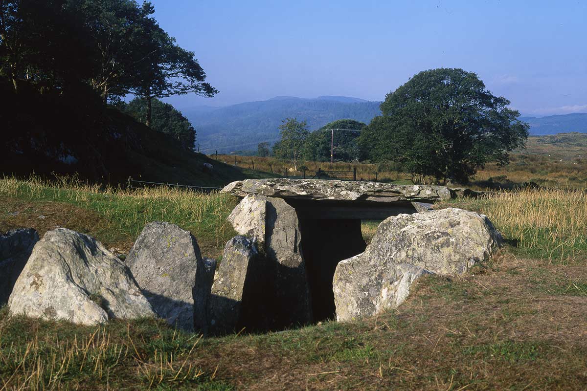
The burial chamber near the North Wales village of Capel Garmon has a magnificent location on upland above the popular tourist village of Betws-y-Coed. It’s within sight of Moel Siabod, the most prominent peak in this eastern corner of Eryri, better known as the Snowdonia National Park.
The tomb, with a ditch below the capstone, is more intact than many such ancient burial chambers in Wales. However, it’s all a bit of a mystery. The only other similar chambered tombs in Britain are found over 150 miles to the south, around the Cotswold Hills and Severn estuary in Gloucestershire. So quite why it was built there, and by whom, is something we’ll probably never know. My guess is that someone with knowledge of such chambers in southwest England ended up living in this part of North Wales, or a group migrated there.
The burial chamber is around a mile south of the village of Capel Garmon, in a field close to a farm. Some people have recently reported problems accessing the monument with dogs running loose there, so my advice is not to go too far out of your way to get there. I’ll update the article as soon as I hear further news.
Where To Stay – Ty Gwyn Hotel – centuries-old coaching inn in Betws-y-Coed
Tre’r Ceiri Iron Age Hillfort

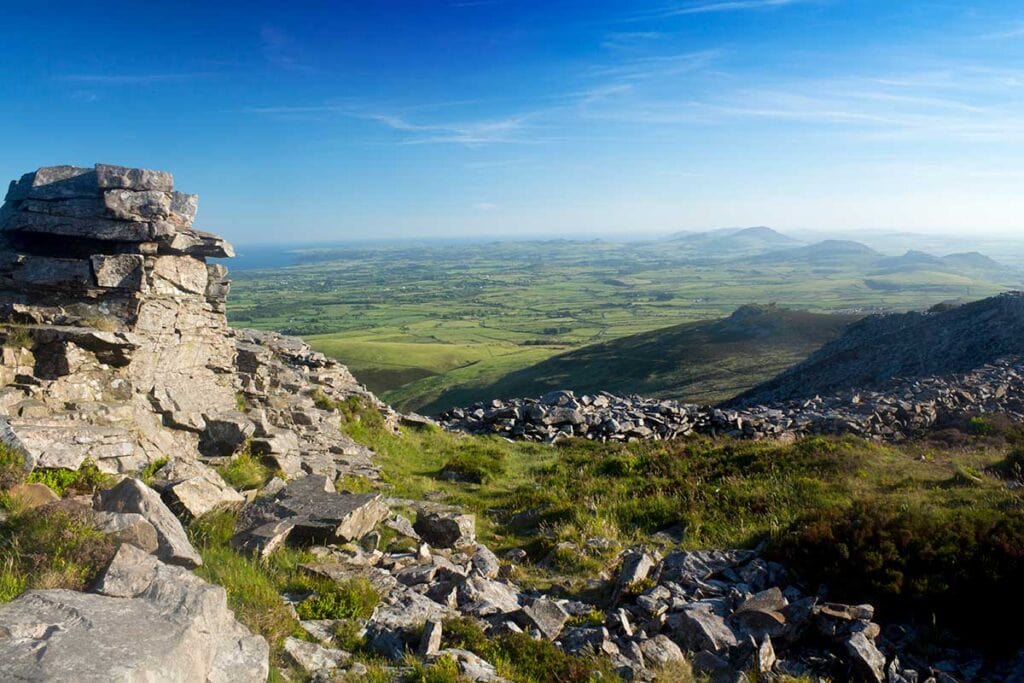
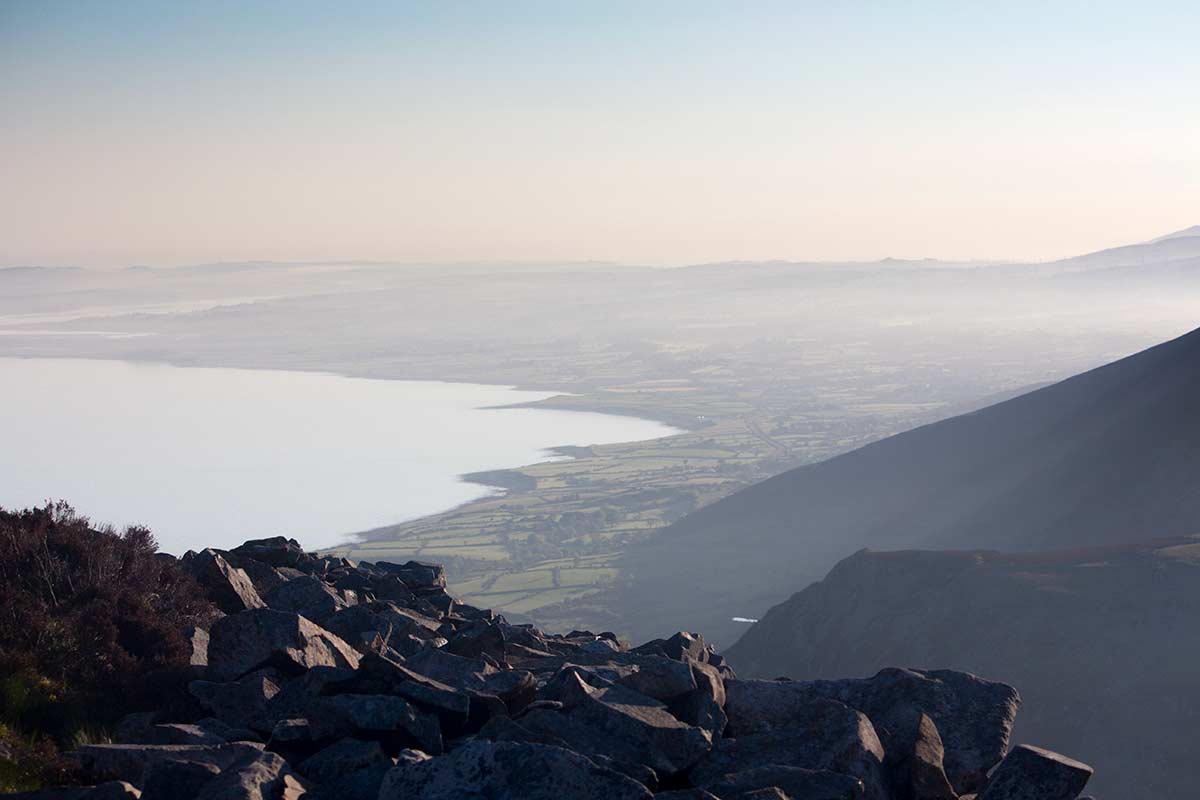
This mountaintop Iron Age settlement is the most dramatic of all ancient sites in Wales. Its name means the Town of Giants, and whoever lived in this remote, exposed place would certainly have needed healthy lungs and limbs to make their way up and down the mountain.
Tre’r Ceiri occupies one of the three summits that make up Yr Eifl (often anglicized to The Rivals), the peaks that dominate the northern coast of the Llŷn Peninsula in North Wales. There is an outer wall, and an extensive series of hut foundations, where the inhabitants would once have sheltered against the constant onslaught of the elements.
The settlement is believed to be around 2,000 years old. It would have been a forbidding place to attack, and the defenders would have had many advantages, including incredible views along the Caernarfon Bay coast and the mountain passes below. This is partly why I included Tre’r Ceiri in my Wales bucket list article.
It’s rare that you won’t have this place to yourself, even though the Llŷn Peninsula beaches nearby are usually busy. I’ve hiked up to Tre’r Ceiri four times, and it took me 25-30 minutes each time, at peak fitness. Photographers I’ve sent there on assignment have told me that it has taken them more like 45 minutes.
The path up begins on the B4417 road between Llithfaen and Llanaelhaearn. There is room for four, at a push five, vehicles, a signpost and a stile.
Where To Stay – Plas Dinas Country House Hotel – once the home of Lord Snowdon, and one of the best hotels in North Wales
See Also: 16 Best Things To Do On The Llŷn Peninsula
Tinkinswood Burial Chamber
If you grew up in South Wales and studied History in high school, you will almost certainly have heard of Tinkinswood Burial Chamber, even if you’ve never visited it. It’s just a few miles west of the capital Cardiff, just as you get your first taste of the fresh air of the Vale of Glamorgan countryside.
The chambered tomb is believed to date back to around 4,000 BC. What you see today is the entrance to the tomb, which may well have been a communal burial place for a small village. When the tomb was excavated in 1914, over 900 broken human bones were found – this could have included the remains of 30-40 people. Fragments of so-called ‘Beaker’ drinking vessels have also been found there, indicating that the site was settled around 3,000 BC.
Tinkinswood is also notable for its enormous capstone, estimated to weigh 40 tons, possibly the heaviest such stone in Europe. Historians would dearly love to know how this stone was lifted, and this will probably only be the subject of conjecture.
Several ancient sites in Wales have age-old legends linked to them. It is said that if someone sleeps at the tomb the night before May Day, St John’s Day (June 23rd), or 21st December, he or she will die, go mad or become a poet.
Tinkinswood is one mile south of the village of St Nicholas, on a minor road off the A48 (left if you’re travelling from Cardiff). Follow the sign to Dyffryn Gardens, it’s on the right a short distance before the entrance to the Gardens.
St Lythans Burial Chamber
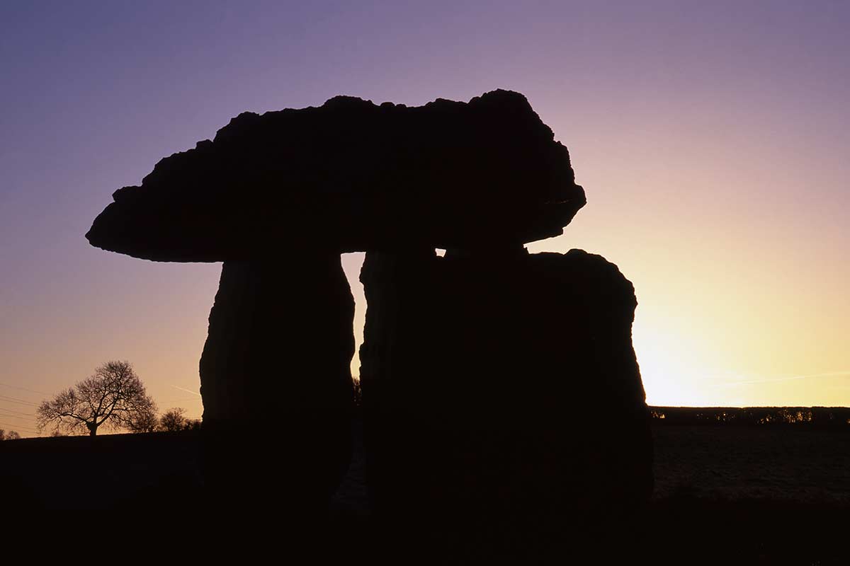
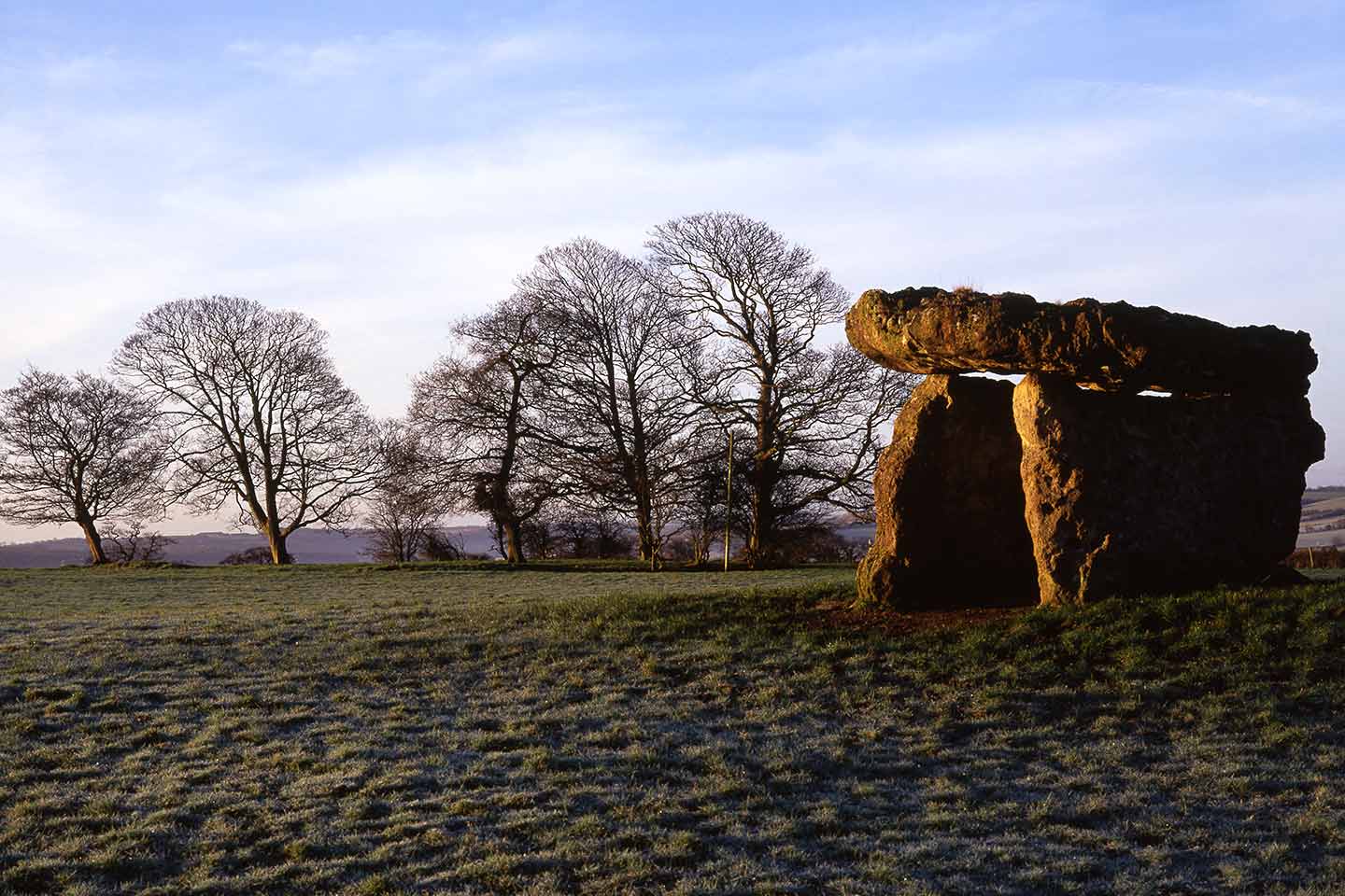
It makes sense to visit St Lythans Burial Chamber at the same time as Tinkinswood and Dyffryn Gardens, as this burial chamber is only a very short drive or walk away.
You may often share your time at St Lythan’s with sheep or cattle, which usually graze in the field in which the tomb stands. It’s a short walk uphill from the gate, where there are a few parking spaces on the minor road running past.
It’s an impressive burial chamber, with a long capstone standing on three supporting stones. Unlike nearby Tinkinswood, it has never been fully excavated, but it’s estimated that the site may well be 5,000 to 6,000 years old.
Bryn Celli Ddu Burial Chamber

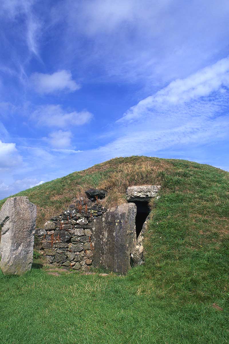
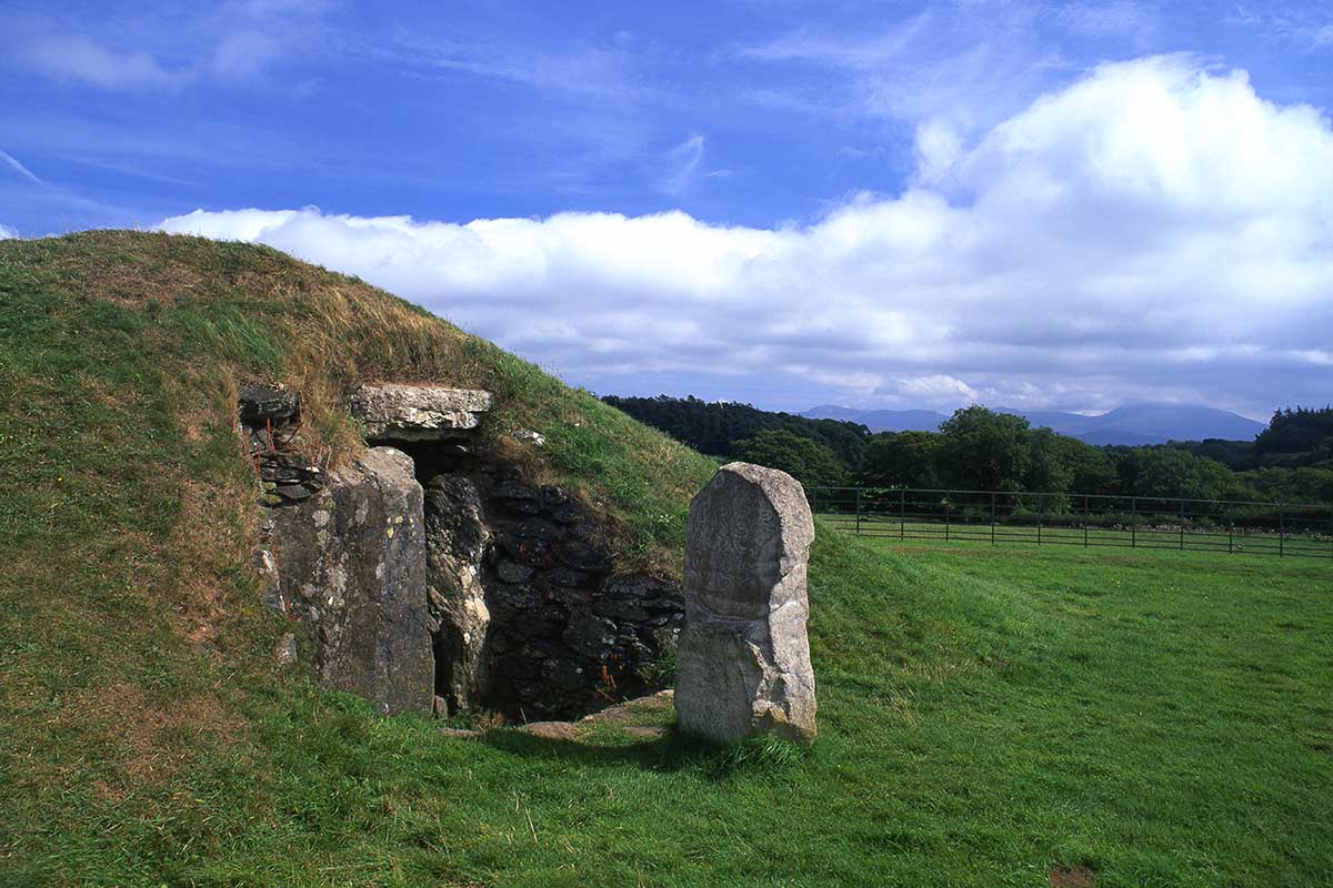
Bryn Celli Ddu – the Mound in the Black Grove – is one of the most fascinating places to visit on Anglesey. The island just off the coast of mainland North Wales is rich in prehistoric monuments, and this is possibly the most impressive of many.
Bryn Celli Ddu is unusual in that it’s a rare survival of a passage tomb, which visitors can walk (while ducking!) inside. On just one day a year, June 21st, the summer solstice, the rising sun shines through the northeast (back) opening and illuminates the passageway.
The tomb is surrounded by a ditch, but a stone circle would have previously enclosed the site. The circle may have been in place around 3,000 BC, and the present tomb – which was likely considerably larger – would probably have been built around 2,000 BC. The carved patterned stone next to the mound is a replica of the original, which is now in the National Museum of Wales in Cardiff.
Bryn Celli Ddu is a short drive from the village of Llanfair PG, the abbreviated name of the longest place name in Wales and the UK. The turn off the A4080 for it is just past the entrance to the National Trust-owned Plas Newydd House and Gardens. And if you continue along the A4080, you’ll reach the turn-off for one of the most beautiful places in Wales, Llanddwyn Island.
Coetan Arthur, St David’s Head, St David’s
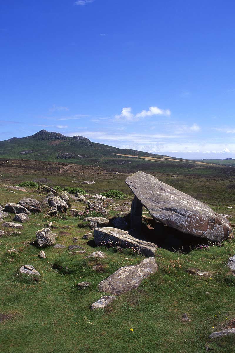
St David’s Head – Penmaen Dewi – is an area rich in ancient history. There are traces of what may have been an Iron Age village on the headland, and among the many scattered stones, this magnificent burial chamber.
Unusually, the large capstone is only supported by a single stone, around 1.5 metres high. Its name Coetan Arthur means Arthur’s Quoit, and it’s one of several similar sites around Wales to be named after the legendary British king.
Despite its magnificence, there are no signposts to Coetan Arthur. My advice is to follow the Coast Path from Whitesands Bay, continuing around the glorious hidden beach at Porthmelgan and onwards uphill. As you continue along this section of the path you may briefly see the outline of the burial chamber up the hill on your right.
The Coast Path continues as far as the ancient settlement, and from here you continue towards the northern side of the headland. You should then catch sight of the burial chamber around 50 metres off the path to your right. It’s an awesome sight, and finding it is one of the best things to do in St David’s, in my humble opinion.
Carreg Samson, Abercastell, Pembrokeshire

Carreg Samson – Samson’s Stone – is one of the most dramatically sited ancient sites in Wales. It’s located in a farm field (used for pasture) less than a mile west of the village and harbour of Abercastle, and commands superb views of the stretch of north Pembrokeshire coast between the Iron Age hillfort of Garn Fawr and Strumble Head.
We don’t know a great deal about the site. It’s around 5,000 years old, from the late Neolithic period, and has been excavated once, in 1968, when some bones, tools and fragments of pottery were found.
Carreg Samson – which is occasionally also called the Longhouse tomb – is just off the Abercastle to Trefin section of the Wales Coast Path, one of the quieter sections of the Pembrokeshire leg of this epic long-distance walk.
See Also: Pembrokeshire Road Trip – 5 Days In Glorious West Wales
Dyffryn Ardudwy Burial Chamber
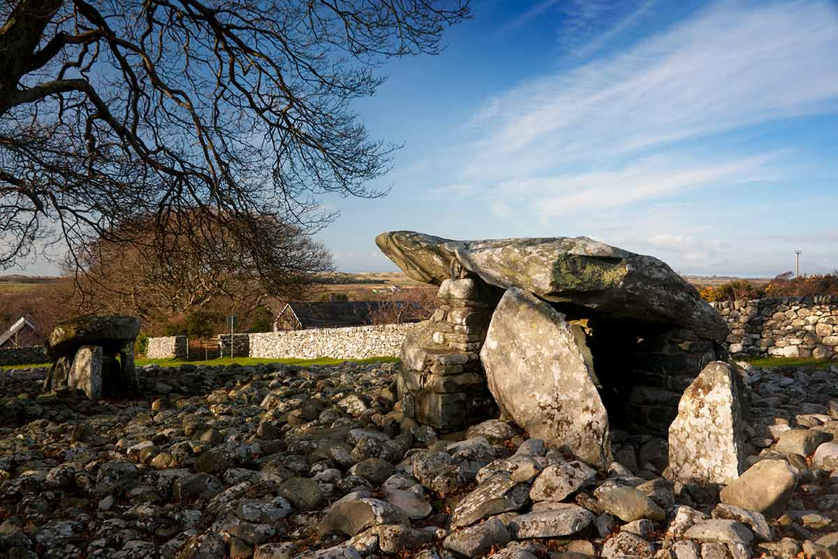

This site consists of two separate well-preserved chambered tombs just outside the seaside village of the same name, a few miles north of Barmouth.
The tombs were built at different times, possibly a century or more apart, and are connected by a large stone cairn around 30 metres long. There is another notable burial chamber, Cors-y-Gedol, a further ten minutes’ walk from the village.
This impressive site is a 5-minute walk from the main A496 coast road which runs through the village. It’s only a few minutes’ walk from Bennar beach, one of the best Cardigan Bay beaches. For more information on places to visit in the area, take a look at my guide to the best things to do in Barmouth.
Penrhosfeilw Standing Stones
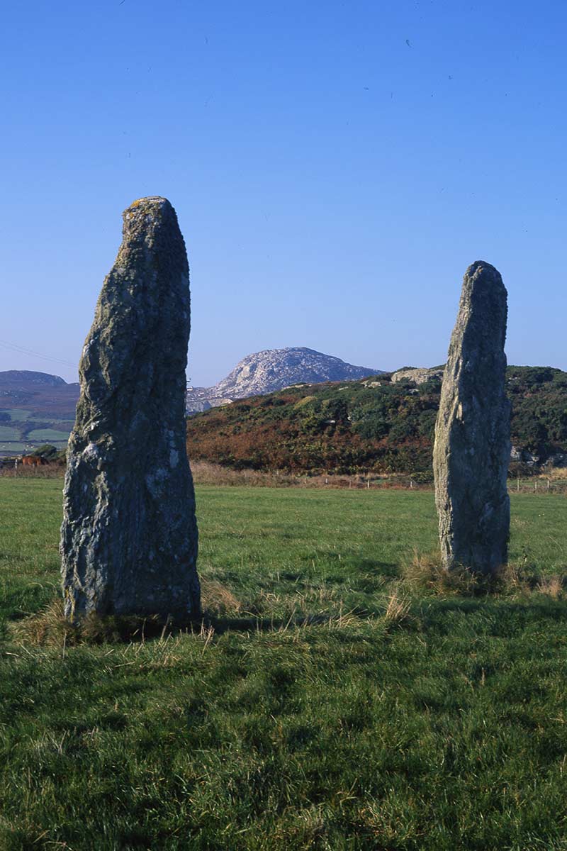
These mysterious ten-feet-tall standing stones stand in a field within sight of Holyhead Mountain, just off the Trearddur Bay to South Stack coast road.
Despite their proximity to popular beaches (Porth Dafarch is the closest) and Holyhead this area still feels wild, and there are more ancient sites close by including the Holyhead Mountain Hut Circles and Caer y Twr Hillfort on the summit.
We don’t know the purpose of these two standing stones. The marker stone theory probably doesn’t hold weight because one would have been sufficient. And the notion that they may have been part of a larger circle of stones has also been dismissed.
Lligwy Burial Chamber, near Moelfre, Anglesey
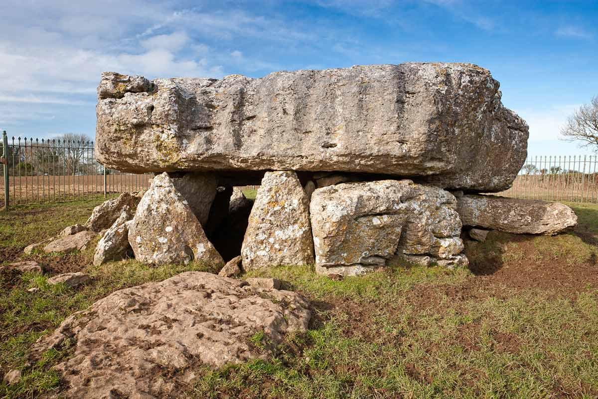
This is a real beast of a burial chamber, about a mile due west of the village of Moelfre on the east coast of Anglesey. My son often compares things he sees with animals, and when I showed him the image above he said, ’It’s like a hippo sitting on something small and squashing it!’ The capstone, weighing around 25 tons, is immense. I think of it more as Neolithic Brutalism, a 5,000-year-old forerunner of the concrete carbuncles of the 1960s amd 1970s that some of us have grown to love.
The burial chamber, which is from the late Neolithic period (around 3,000 BC), was excavated in the early 20th century, and bones of up to 30 people, as well as animal bones and shellfish remnants, were uncovered there.
Lligwy Burial Chamber can be reached by minor road off the A5108 just south of Moelfre. It’s close to a few later historical sites – the 2,000-year-old Din Lligwy Hut Group, the ruined 12th-century Capel Lligwy and, just over a mile to the south, St Gallgo’s Church in Llanallgo.
There is a memorial in the churchyard to the victims of the 1859 Royal Charter disaster, in which around 450 people died when the steamship of the same name crashed onto the rocky coast north of Moelfre.
Maen Llia, Ystradfellte
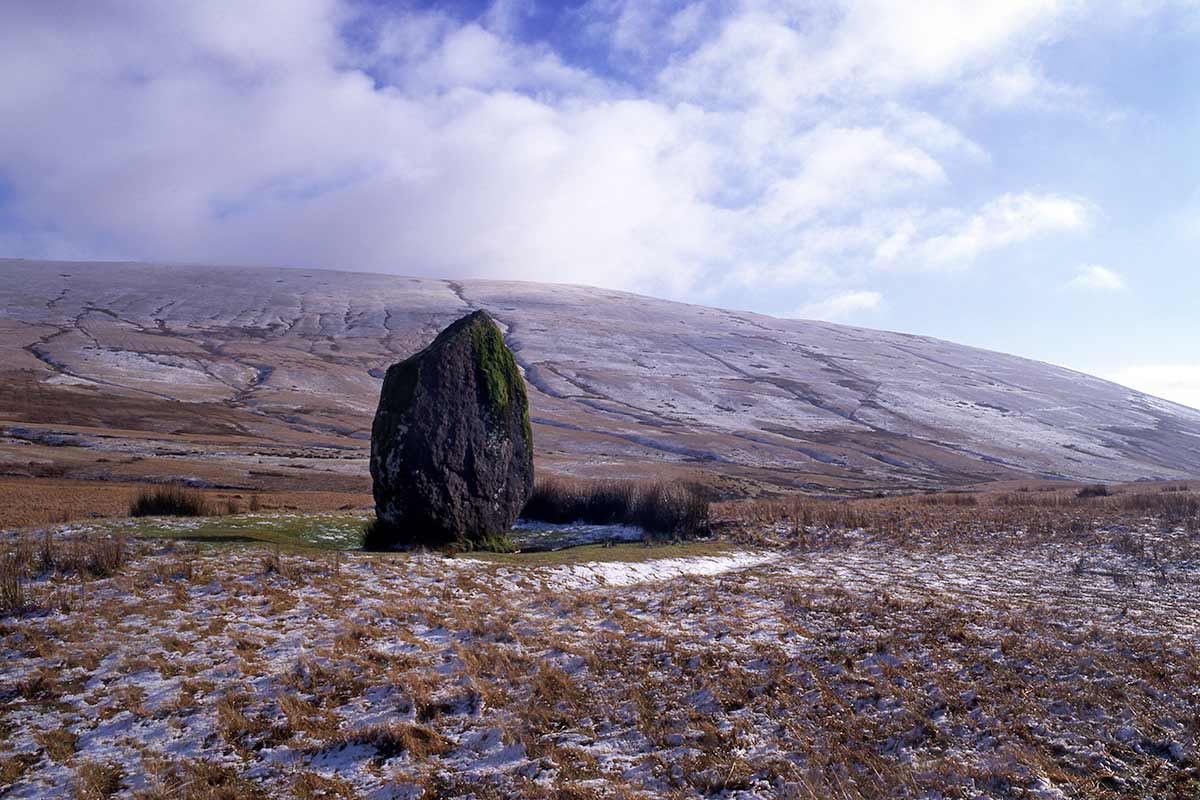
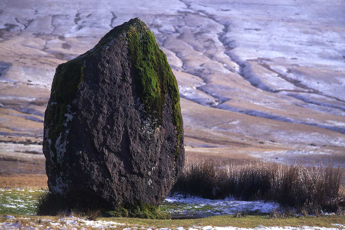
High in the Brecon Beacons mountains, on one of the best scenic drives in Wales, Maen Llia is an ancient standing stone on the minor road from Ystradfellte through Fforest Fawr. It’s also just a few miles north of the biggest concentration of Brecon Beacons waterfalls.
Maen Llia – which means ‘Stone on the Llia River’ – could be up to 5,000 years old. It’s part of an alignment of more stones and a cairn nearby, so it may have had some religious significance, rather than a waymarker post as has previously been suggested.
Soon after you pass the stone (on the right as you drive north from Ystradfellte) you come to a wonderful viewpoint of the Senni Valley, one of the least-known but most beautiful corners of Bannau Brycheiniog.
Twmbarlwm Iron Age Hillfort
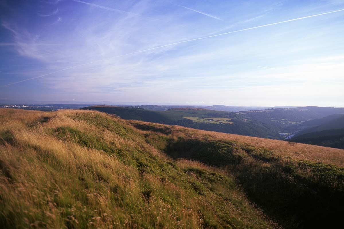
The Cwmcarn Forest Drive above Risca has long been one of the most popular things to do in the South Wales Valleys. And the highlight of this drive is the short, sharp hike to the summit of Twmbarlwm, the highest point on the hills overlooking the Bristol Channel coast.
The summit, on the end of a long ridge, is often called a ‘tump’, a word commonly used in South Wales to describe a small rise or hillock like this. It is certainly man-made, and could well have been a hillfort built by the local Silures people during the Iron Age. It’s believed that it was also the location of a Norman motte and bailey castle a thousand or more years later. It’s certainly a well-chosen strategic site, with views to the Bristol Channel and the Somerset coast, the valley of the Ebbw River below and the hills to Caerphilly Mountain and beyond.
Twmbarlwm was also a stop on one of the most important pilgrimages in Wales, on the route from Llantarnam Abbey to the Holy Well at Penrhys in the Rhondda. Author Arthur Machen – who may have taken his pen name from a village over the hill to the south – was also fascinated by Twmbarlwm, a ‘mystic tumulus’ that was a memorial to the ancient people that once lived in the region.
Caerleon Amphitheatre and Caerwent Roman Town


I’ve included these two Roman sites in South Wales as it makes sense to visit the two of them on the same day, particularly if you’re visiting from outside the South East Wales region, as they are only ten miles (17 km) apart.
They aren’t very well known internationally, but Caerleon and Caerwent are two of the most significant Roman monuments in Europe. Caerleon, then known as Isca Augusta, was one of the Roman Empire’s most important garrisons in Britain, established around 75 AD to subjugate the local Silures people. The Amphitheatre is the most prominent sight, but the National Roman Legionary Museum and Caerleon Roman Baths have plenty to show you about life in this peripheral provincial outpost of the Roman Empire.
Caerleon gets a steady trickle of tourists, but Caerwent, close to the Prince Charles Bridge over the Severn estuary, is one of the true hidden gems of Wales. I’ve visited several times down the years, and never seen another soul there.
This is remarkable as it has one of the best-preserved town wall circuits anywhere in the Empire. Several towers remain, each about 15 feet (5 metres) in height, and as you’ll see from the image above, they are sturdy constructions indeed.
Bryn Cader Faner
Bryn Cader Faner is one of the most remote ancient sites in Wales, high up in the northern part of the Rhinog range in the ancient Ardudwy region of the county of Gwynedd.
It also requires a longer hike than most – I’d rate this the second most difficult of the walks in this article after the shorter, steeper walk to Tre’r Ceiri.
Bryn Cader Faner is an ancient Bronze Age ring cairn, on a mountainside with sublime views over the Dwyryd estuary and Portmeirion, and north to Yr Wyddfa (Snowdon), the highest peak in Wales. The circle of stones has an arrangement of slightly higher stones around the periphery, giving it the appearance of a crown of thorns from some angles.
The easiest way to reach the site is by parking at the end of the minor road from the hamlet of Eisingrug, passing the re-opened Maes y Neuadd Country House on the way. From there, a discernible track takes you across the moors, through a few classic Welsh bogs (it wouldn’t be Wales without them!) before you reach the cairn.
For more to see in the area, check out my guide to the best things to do in Harlech.
Sweyne’s Howes Burial Chamber, Rhossili, Gower Peninsula
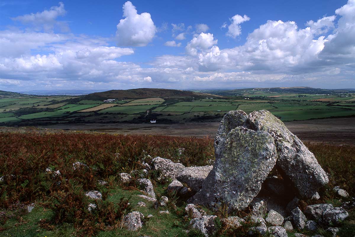
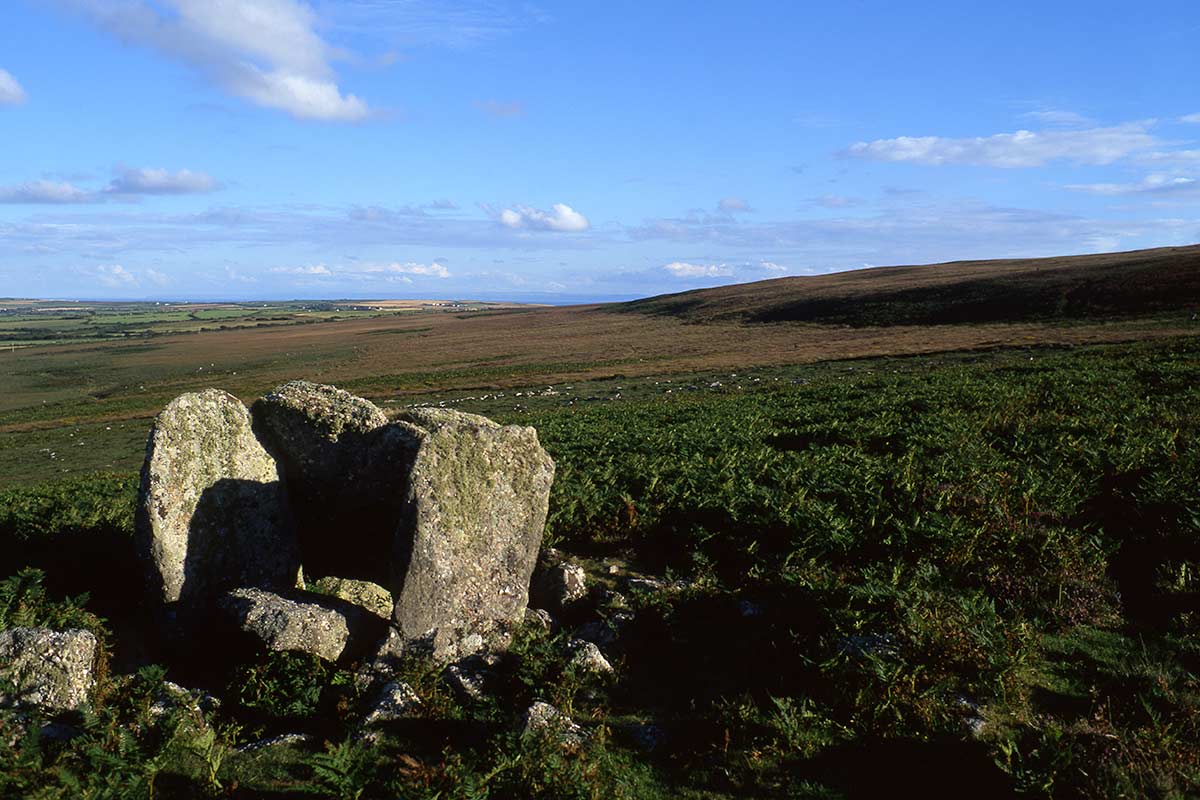
One of our favourite Gower walks takes you up the steep slope of Rhossili Down from the village. After passing the summit cairn the path continues for about half a mile, by which time you should be able to make out two cairns lower down the slope to your right (and to the east).
The two chambers – named after a Norse chieftain – are believed to be around 4,000 years old, and would have been connected. The first chamber you’ll encounter is in a considerably better state of repair than the other, a small burial chamber with some stones still standing. The second chamber lies a few metres away, the stones lying scattered on the ground.
The best time to see Sweyne’s Howes is in the summer (late July to early September) when the pink and purple heather around the stones is in bloom. And don’t miss the views from the ridge overlooking Rhossili Bay, one of the outstanding beaches in Gower and indeed Wales.
Great Orme Copper Mine, Llandudno
We visited the Great Orme many times on our holidays in North Wales back in the 1980s. Never did we have the faintest idea that we could have been walking above one of the archaeological finds of the decade – the Great Orme Copper Mines.
The Great Orme is the large limestone headland that towers between Llandudno’s two beaches, West Shore and North Shore. The Copper Mines are one of several attractions around the headland, and you can reach them by the Cable Car or Great Orme Tramway. The blue route of the hop-on-hop-off Llandudno bus tour also drops visitors there.
The site was mined for copper during the Bronze Age, probably between 3,500 and 4,000 years ago. You can now visit the open cast section and a 200-metre-long underground trail. The attraction also includes a short film, and you can watch copper being smelted too.
Tickets for adults cost £12.50, children £7.50, and a family ticket saves you a few pounds at £33.50. The Mines are open between April and late October.
Maen Achwyfan
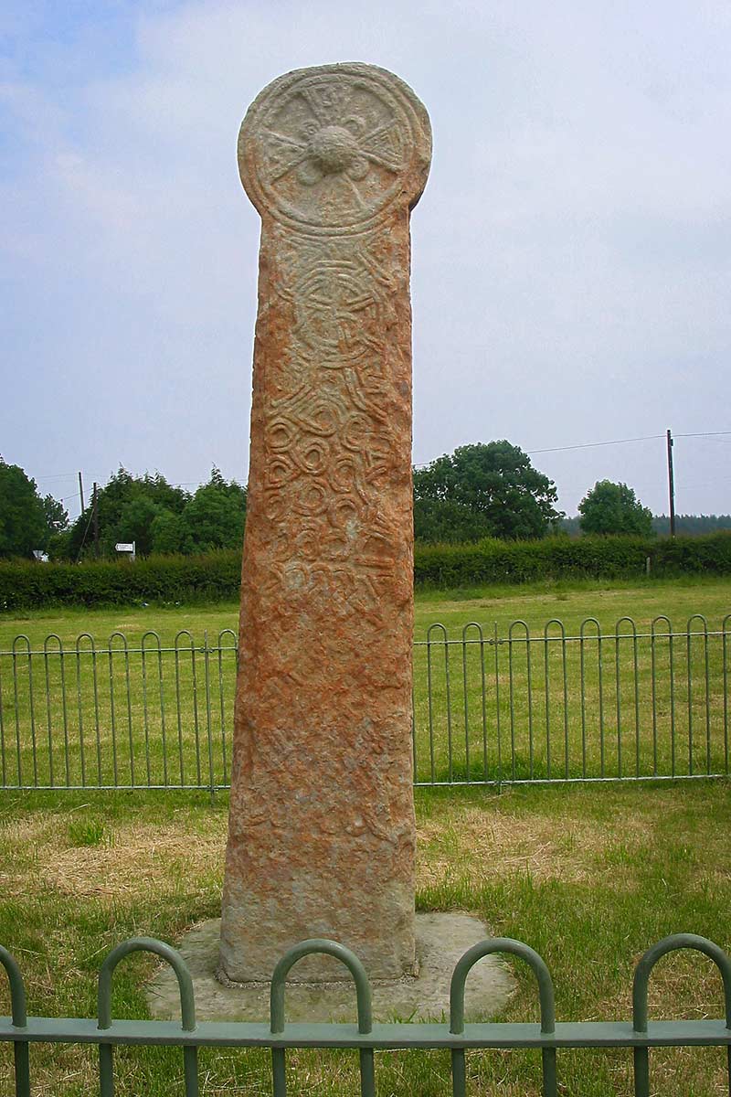
Along with the crosses in Nevern and Carew, this Celtic cross in rural Flintshire, in North East Wales, is one the finest of its kind in Wales.
Like the other two crosses it’s intricately carved with Celtic knot patterns, and there is also, intriguingly, a figure of a naked man holding a spear and standing on what appears to be a snake. This carving is on the east side of the cross, so if you’re visiting on a sunny day, you’ll be able to appreciate it better in the morning.
It’s around 3 miles northwest of the pilgrimage site of Holywell, where you can visit St Winefride’s Well and, just down the hill from there, the Gothic ruins of Basingwerk Abbey in Greenfield.
See Also: Best Places To Visit In North East Wales
Ancient Sites In Wales – Final Thoughts
I hope you have enjoyed this guide to some wonderful ancient sites around Wales. I have provided numerous links to other articles over the course of this guide, and I also suggest taking a look at my guides to the best castles in North Wales and the best castles in South Wales for ideas on places to visit while travelling in the country.
And for further inspiration take a look at some of the articles below:
Landscapes in Wales – Breathtaking landscapes in Wales you must see
Rivers in Wales – Some of the most beautiful scenery in Wales
Lakes in Wales – Where you find some of the best views in Wales
Landmarks in Wales – famous places in Wales to Explore
Best things to do in Conwy – A stunning UNESCO Heritage town on the edge of Snowdonia National Park
Portmeirion – A gorgeous Italianate village on an estuary on the North Wales coast
Welsh Slate Landscape – UNESCO World Heritage Site North West Wales
Llanddwyn Island – One of the most special of all Welsh islands
Anglesey beaches & coastline – Home to some of the best beaches in the UK
Best walks on Anglesey – Eight of the best Anglesey walks to help you discover more of this magnificent island
Best things to do on Anglesey – the largest of Welsh Islands

About the Author: David Angel is a Welsh photographer, writer and historian who has spent a lifetime exploring and photographing his homeland. Former Art Director and Commissioning Editor for Visit Wales, he worked on major tourism campaigns promoting Wales around the world, including successful bids and marketing campaigns for UNESCO World Heritage Sites, the Ryder Cup and a UEFA Champions League Final. Fluent in Welsh and English, he draws on that deep local knowledge to create detailed travel guides designed to help visitors discover the very best of Wales.